When it comes to wildfires, there aren’t too many silver linings to be found. They often lead to damaged property, harm to local ecosystems, loss of power, loss of telecommunications access, and even fatalities. The damage caused by a wildfire can take years to fully recover.
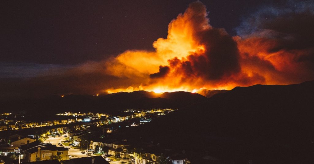
However, drone technology is helping the authorities in the fight against wildfires in ways that just weren’t possible 15 years ago. GenPac Drones has been at the forefront of this fight, providing authorities in California and the Pacific Northwest with the equipment and expertise to survey the damage after devastating wildfires. One historical fire was the fire in 2018 that claimed 103 lives and damaged more than 24,000 properties- The Camp Fire that swept through Paradise, CA https://en.wikipedia.org/wiki/Camp_Fire_(2018). Our drones were used to survey the aftermath of the fires, gathering data that has helped the state make plans to rebuild. For more information on how that effort is going, visit https://www.rebuildparadise.org/
Drone technology is set to be a huge part of the future of wildfire response. So how can drones be used to respond to wildfires, and what makes them better than the alternatives?
Inspection and mapping
Capturing an accurate snapshot of the situation following a wildfire is absolutely invaluable data for state and city authorities responding to a wildfire. This kind of information is difficult and time-consuming to gather on foot, due to health and safety concerns, as well as the difficulty in traversing a recently burned landscape. Drones can gather accurate data in a fraction of the time, without any risk to human life. A drone can gather the same amount of data in minutes that would take a team of people on the ground days to collect.
Drones can even be used to monitor ongoing wildfires, which is impossible on foot, and possible but dangerous using a helicopter. This can help them to spot areas where they can carry out controlled burning to bring the wildfire under control, as well as quickly identifying towns that are at risk so that residents can be evacuated.
Drones that are used to combat ongoing wildfires are often equipped with thermal cameras. These allow the authorities to find hotspots, which can quickly be communicated with the fire department to help them tackle the fires. Thermal cameras can also help to identify people who are trapped in dangerous areas, the kind of information that is impossible to access with the naked eye alone.
Getting so much information about a wildfire quickly allows state and city authorities to provide a quicker and more robust response.
Using drones is safer than boots on the ground
A drone is by far the safest way to inspect and map out the damage caused by a wildfire. This would previously be carried out via helicopter or on foot, but both methods are slower and much more dangerous. Walking through an area affected by wildfires can be dangerous due to the risk of fire, as well as the risk of damaged buildings and structures which can easily fall apart and cause harm. Using a helicopter is safer, but still not risk-free, as it requires humans to get close to dangerous areas.
Drones allow surveyors to get a much closer and clearer picture of the damage- drones can safely fly at a lower altitude when compared to a helicopter, getting data that just wouldn’t be accessible while using a manned aircraft. The worst thing that can happen is that the drone itself could become damaged or destroyed, which has financial implications but causes minimal risk to human safety.
Mitigating the risk of future wildfires
As well as surveying damage, drones can be used to help mitigate the risks of wildfires occurring in the future. One way they can do so is by helping the authorities carry out controlled burns. A controlled burn is when vegetation is purposefully burned in order to protect inhabited areas from wildfires. This means that should a wildfire strike, the fire will not have enough fuel and will stop burning, saving lives and properties.
By getting a full aerial picture, drones can be used to identify areas that are susceptible to wildfires and quickly identify vegetation that can be burned in a controlled manner. Additionally, drones can be equipped with hardware that allows a drone pilot to carry out a controlled burn from a safe distance. This is traditionally done on foot, which takes a long time and is fraught with dangers. By contrast, prescribed burning can be carried out via drone quickly and safely.
Powerline inspection
Faulty powerlines are a common cause of wildfires, so they must be checked regularly in areas that are susceptible to unexpected and uncontrolled burning. Traditionally, powerline inspection was a slow and manual process that was done on foot. This process could also be helped by a team in a helicopter who would fly ahead and identify any potential issues from afar, but ultimately any close examinations had to be carried out manually.
However, powerline inspections can now be carried out quickly and safely by using drones. While having a human climb up a transmission tower takes a long time and has a number of health risks, remotely flying a drone to the same place to do the same job is quick and safe. This also allows for more frequent inspections, as it is much less of a drain on resources.
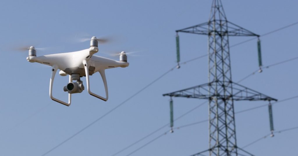
As well as carrying out the role of crews on foot, drones can also carry out the role helicopters would have played previously. By ascending higher into the sky, a drone operator can get a bird’s eye view that can highlight any potential issues with the powerline. This allows them to then navigate the drone to those issues to get a closer look all within the same flight. This blend of top-down and up-close views is something that can’t be matched by helicopters or ground crews alone.
Drones as a firefighting tool
Drones are becoming an essential tool in the battle against wildfires across the world. Interested in using drones to survey damage caused by wildfires in your area? Contact Chad Nelson, an industry leader in utility drones, for more information: [email protected] or check out our website- GenPacDrones.com
