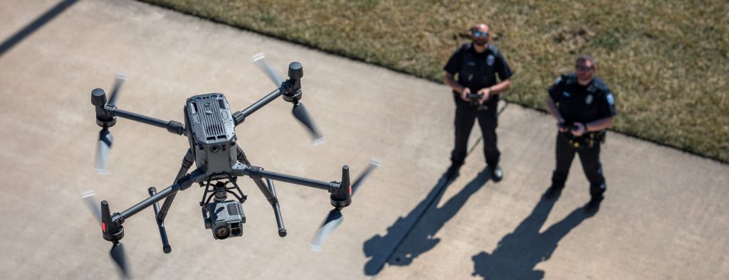
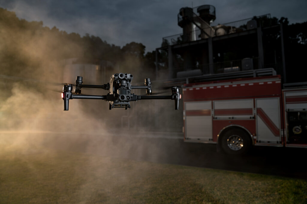
Unmanned aerial vehicles (UAVs), commonly known as drones, are revolutionizing various industries with their ability to access hard-to-reach areas and capture real-time data. New UAV technology drones have proven especially beneficial for search and rescue (SAR) operations, where time is of the essence. Innovations in UAV technologies make drones an indispensable tool for SAR teams.
How do Drones Enhance Search and Rescue Missions?
Drones offer unique advantages that improve the effectiveness of SAR missions:
Aerial perspective – Drones provide an aerial view to locate missing people, identify dangers, and map out areas. This bird’s-eye view is impossible to achieve from the ground
Access remote areas – Military unmanned drones can easily access rough terrain, dense forests, ravines, mountains, and other hard-to-navigate areas. This expands the search area significantly.
Real-time data – Drones transmit live video feeds and images to SAR teams on the ground, providing instant information to aid rescue efforts.
Precise tracking – Advanced GPS and sensory technologies allow drones to pinpoint locations precisely. This helps SAR teams find victims faster.
Night operations – Drones equipped with thermal imaging cameras can continue search operations after dark when manned helicopters are grounded.
Reduced risk – New UAV technology drones keep rescue personnel from potentially dangerous areas like flooded rivers, wildfires, or collapsed buildings.
Latest UAV Technology Advances for SAR Drones
Innovations in drone technology are making them even more valuable for search and rescue missions:
1. Longer Flight Times
Extended battery life and improved power efficiency allow drones to stay airborne longer. The **DJI M30** series offers up to 55 minutes of flight time, while the **Autel EVO Max 4T** provides 40 minutes of operation. This increased endurance lets drones cover more ground during time-sensitive SAR missions.
2. Enhanced Sensors
Advanced drone sensor suites like the **DJI M30** and **Autel EVO Max 4T** include visual cameras, thermal imagers, hyperspectral sensors, lidar, and more. These enhanced eyes in the sky identify signs of life, dangers, and access routes to guide rescuers.
3. AI Object Tracking
Artificial intelligence (AI) gives drones automated object-tracking capabilities. The latest **DJI M30** series can lock onto people and vehicles, following them persistently. DJI latest drones are invaluable for keeping victims in sight during rescues.
4. Larger Communication Range
New drones maintain a robust control and video link across longer distances. The **DJI M30** has a 15km HD video transmission range, while the **Autel EVO** offers 8km. Teams can operate drones beyond visual line-of-sight (BVLOS) to expand search areas.
5. Improved Durability
Rugged drone airframes and water/dustproof designs allow them to operate in all weather and environments. Drones like the **DJI Matrice 300 RTK** can withstand winds up to 44 knots, rain, and drops onto concrete. This durability enables use in harsh SAR situations.
6. Faster Top Speeds
High-speed drones like the 90 kph **Autel EVO Max 4T** get to search areas quicker and pursue moving targets. Their speed aids in rapid response and tracking during time-sensitive SAR missions.
7. Modular Payloads
Quick-swap drone payload bays like on the **DJI M30** allow SAR teams to reconfigure sensors on the fly. Switching payloads from zoom cameras to thermal lets drones rapidly adapt to changing mission needs.
8. Automated Flight
Programmable flight patterns and automation through tools like **DJI FlightHub** reduce pilot workload. Rescuers can focus on spotting victims while drones autonomously scan terrain and obstacles.

Cutting-Edge Military SAR Drones
The military utilizes state-of-the-art unmanned aerial systems (UAS) technology purpose-built for combat SAR operations:
MQ-9 Reaper – Heavily armed, this drone also carries advanced radar and sensors to penetrate deep into enemy areas for CSAR missions.
AirRobot AR200 – Small and portable, this VTOL drone is made for special forces to carry in backpacks for rapid SAR deployments behind lines.
InstantEye MK-3 GEN5 – Fitting in a single hand, these nano-drones provide over-the-hill reconnaissance in tight urban warfare spaces to locate downed aircrews.
Cobras 2 SAR – Equipped with an acoustic sensor array, this drone can hone in on cell phone pings, distress beacons, and voices to pinpoint people for rescue.
While cost-prohibitive for civilian rescue agencies, this cutting-edge military drone technology highlights the future SAR potential of UAVs. Commercial DJI latest drones will integrate similar capabilities in the coming years.

Drone-Assisted SAR Operations in Action
Drones have proven their life-saving capabilities in numerous real-world SAR situations:
– In 2021, thermal drone imaging two missing hikers after two days of fruitless searching in the woods of New Hampshire.
– During the 2018 Camp Fire disaster in California, drone SAR [teams led by the non-profit “Rebuild Paradise” combed through debris to find missing residents and pets.
– In the aftermath of Hurricane Michael in 2018, drones scanned miles of debris to identify those needing rescue and evacuation routes.
– During Hurricane Harvey flooding, first responders used drones to pluck stranded people off rooftops beyond the reach of watercraft.
As drones continue to provide value in real-world emergencies, SAR agencies are expanding their adoption of UAV technology.
Drone Detection Solutions for Secure SAR Operations
While drones provide invaluable eyes in the sky for SAR, consumer UAVs pose a hazard to human-crewed aviation operations. Rogue drones flying near helicopter search patterns run the risk of midair collision.
Security solutions like “DroneShield” provide airspace surveillance and threat detection to counter this. Their “DroneSentinel” system uses cutting-edge radars to detect, track, and classify approaching drones and can neutralize unauthorized ones. Drone detection solution protects rescue helicopters and ensures unimpeded SAR missions.

FAQs About Drones for Search and Rescue
What sensors are best for SAR drones?
Visual cameras, thermal imagers, and lidar sensors provide complementary capabilities for thorough searches. Zoom cameras aid during daylight, while thermal is crucial for nighttime or dense vegetation.
How much does a SAR drone program cost?
For a basic starter program, expect around $3,500-$5,000 for a drone, pilot training, and accessories. More advanced platforms with multiple sensors can range $10,000-$30,000.
What is the range of a SAR drone?
Smaller drones may have 1-3-mile effective ranges, while larger ones offer 7-15+ mile operation radii depending on conditions. With BVLOS waivers, unlimited-range fixed-wing UAVs are ideal for wide-area searches.
Can drones save lives in emergencies?
Absolutely. New UAV technology drones have proven invaluable in locating victims during disasters and sending help more efficiently. They reduce risk to responders while multiplying search capacity.
What weather can drones operate in?
Newer professional drones can fly in rain, winds up to 40 knots, and even snow—however, extremely dense fog or severe thunderstorms.
Getting Started with a Professional SAR Drone Program
For public safety agencies looking to start their drone program, choosing the suitable airframe and sensors is critical:
– The “DJI Matrice 30” and “Matrice 300 RTK” provide professional-grade performance for rigorous SAR duties. Their modular payloads and intelligent functions make them ideal platforms.
– Rugged fixed-wing drones like the “Paladin UAS” offer unlimited flight time capabilities for extensive range BVLOS operations.
– Multi-sensor cameras like the “H20T Zoom” thermal, visual, and laser payload provide an all-in-one imaging solution for thorough searches.
Beyond capable drones, a complete program needs pilots trained in aerial SAR techniques. The FAA **Part 107 certification** course prepares operators to fly missions within visual line-of-sight (VLOS) legally. For expanded BVLOS flights, the “Public Safety NIST” curriculum teaches techniques tailored to public safety drone missions.
By leveraging the latest professional drone technology and training personnel, SAR teams can maximize the effectiveness of their aerial operations and save more lives.