
Drone Volumetric Services
Precise Measurements. Swift Workflows. Enhanced Planning.
Drone-based volumetric analysis offers an accurate and efficient method for measuring stockpiles, earthworks, and material quantities across construction, mining, and industrial sites. By utilizing high-resolution aerial imagery and advanced 3D modeling, drones provide reliable volume calculations without the time, expense, or safety concerns associated with traditional ground surveys.
Why Choose Drones for Volumetrics?
High-Precision Data
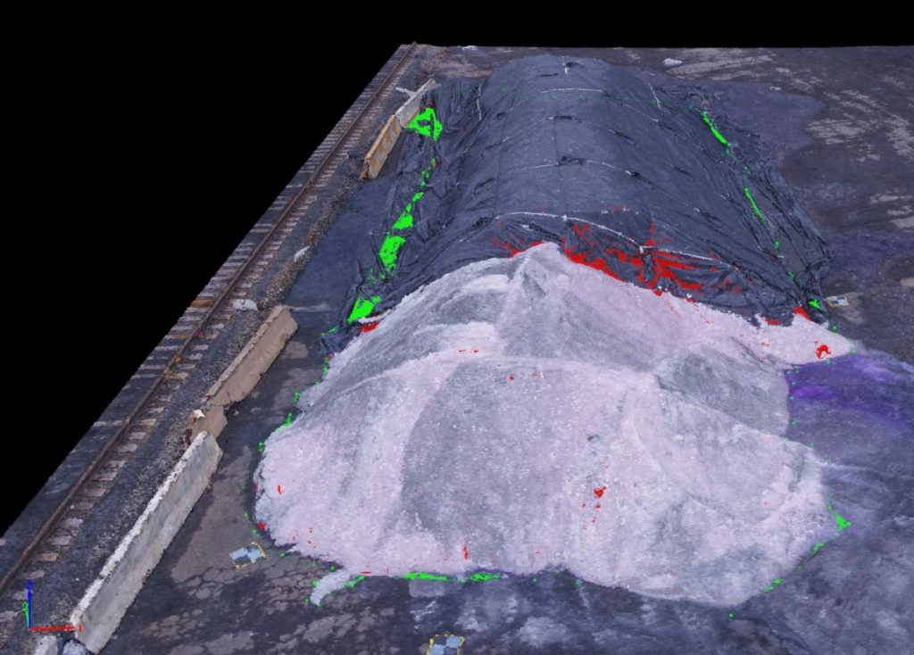
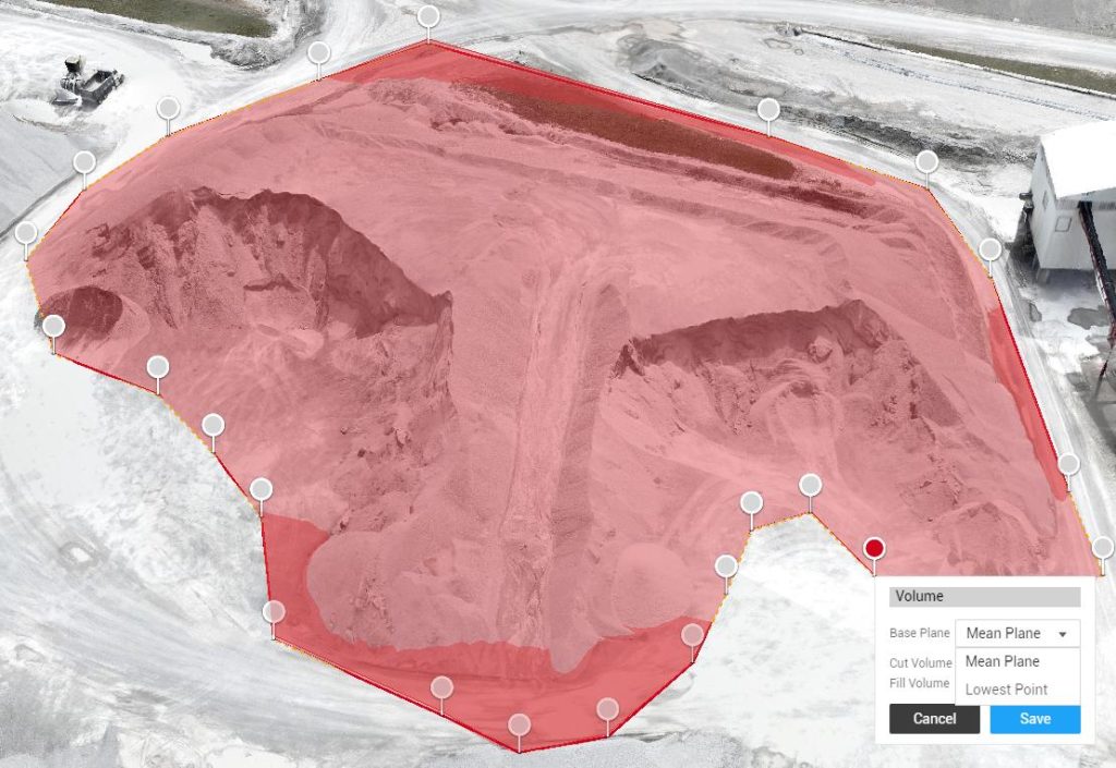
State-of-the-art drone photogrammetry and LiDAR technology capture millions of data points to create intricate 3D models. This capability enables precise volume calculations for stockpiles, pits, spoil heaps, and cut-and-fill areas, aiding in confident planning and reporting.
Rapid Data Collection
A single drone flight can survey an entire site in mere minutes, significantly cutting down field time. Faster data capture leads to quicker processing and more regular updates, allowing teams to stay informed about material usage and project advancements.
Enhanced Safety
Drone volumetrics eliminate the necessity for workers to scale unstable piles or move through heavy-equipment zones. All measurements are conducted remotely, ensuring your team remains safely out of harm’s way.
Cost-Effective Solutions
By decreasing labor hours, minimizing equipment requirements, and streamlining workflows, drone volumetric services present an efficient and budget-friendly alternative to manual measurement techniques.
What We Provide
Our volumetric services encompass:
- Accurate stockpile volume calculations
- Cut-and-fill analysis
- 3D site models and terrain mapping
- Progress tracking for earthworks and material movement
- High-resolution orthomosaics and measurement reports
Suitable for Various Industries
Drone volumetrics cater to operations in:
- Mining & Aggregates – stockpile management, pit mapping, resource planning
- Construction & Earthworks – grading verification, material tracking, site planning
- Land Development – pre-construction analysis, mass-grading estimates
- Environmental & Government – erosion studies, landfill monitoring, flood modeling
Reliable Data for Informed Decisions
With our drone-based volumetric services, you acquire rapid, accurate insights that empower you to manage materials, minimize waste, and adhere to project timelines. Our team provides clear, actionable reports tailored to support your planning, budgeting, and operational requirements.
