
The only end-to-end mapping solution that transforms your drone’s data into actionable insights
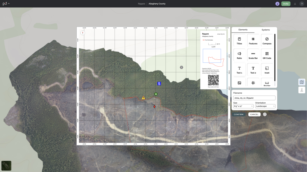
Make map creation as simple as building a PowerPoint presentation—and now, it truly is. Our user-friendly mapping software allows you to quickly generate insightful, impactful maps that enhance decision-making for you, your team, and your clients. With drag-and-drop functionality, seamless data integration, and easy collaboration, Nova Maps transforms complex GIS data into clear, actionable visuals. No GIS degree required—just powerful mapping at your fingertips.
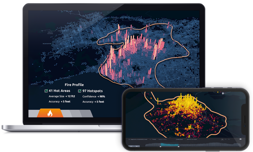
Orthomosaics? Check. Video? Check. Thermal imagery? Check. Nova Maps seamlessly processes all your drone-captured data. Our intuitive software makes aerial mapping straightforward, guiding you through orthomosaic generation, video overlays, and thermal image analysis with ease. With Nova Maps, complex drone data becomes simple, empowering you to focus on insights, not technical hurdles.

Innovative Software for Search and Rescue
Colorfinder gives search and rescue teams a vital edge with its precise color detection capabilities, simplifying the identification of people, clothing, equipment, and other objects of interest. By transforming video footage into color-based timelines, Colorfinder enables operators to track color variations and potential targets across diverse landscapes—whether navigating dense forests, snow-covered fields, or urban environments. This advanced color analysis helps teams quickly zero in on the most relevant footage, saving critical time in high-stakes operations.
From spotting specific clothing colors to highlighting unusual terrain features, Colorfinder delivers unmatched visual search precision. As drones play an increasingly essential role in rescue missions, this tool integrates seamlessly into existing workflows, ensuring responders can efficiently process data and make informed decisions. Designed for clarity and speed, Colorfinder empowers rescue teams to act decisively when every second counts.
