
Drone LiDAR Services
Precision Mapping for Complex Environments
Drone-based LiDAR is revolutionizing surveying, mapping, and 3D data collection. By merging laser-scanning technology with the nimbleness of unmanned aircraft, LiDAR drones gather millions of data points with remarkable accuracy—even in locations where traditional photogrammetry falls short. The outcome is fast, reliable, and intricately detailed 3D models that facilitate smarter planning and improved decision-making.
Why Choose Drone LiDAR?
Unmatched Accuracy
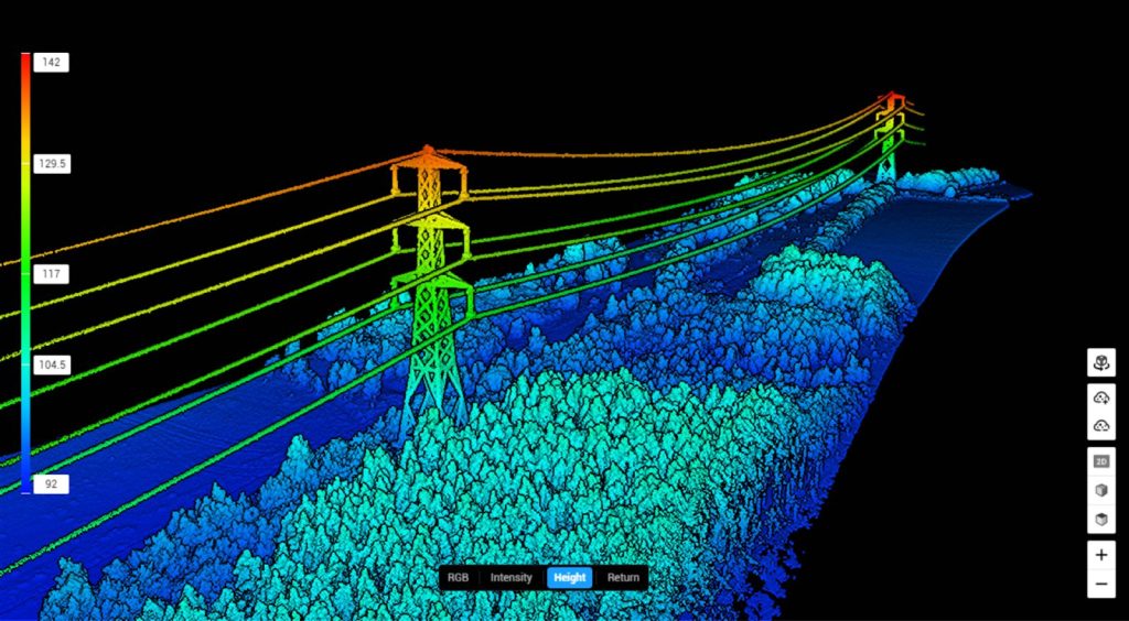
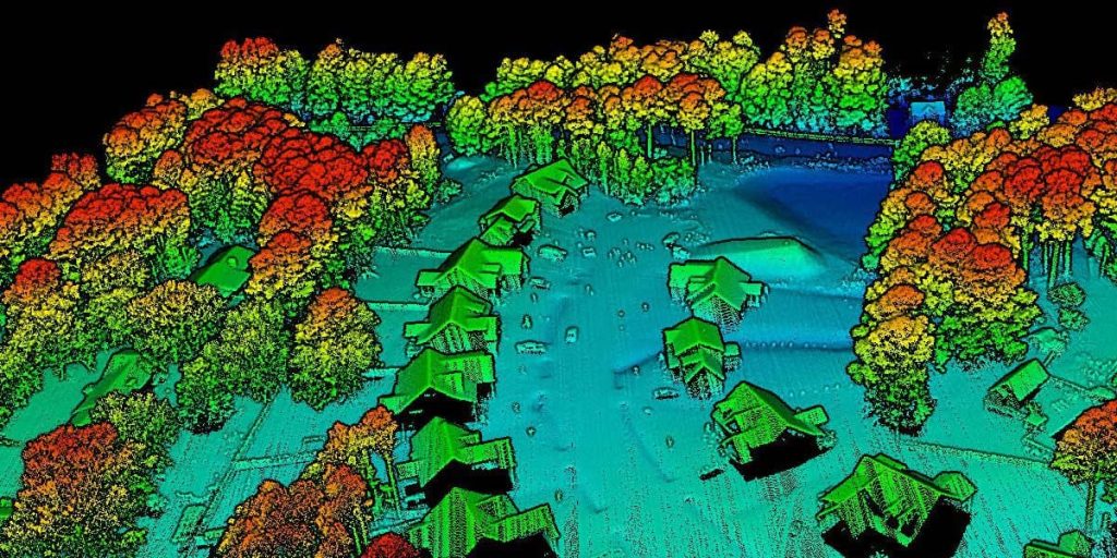
LiDAR sensors can penetrate vegetation to capture precise elevation data, making them perfect for dense forests, uneven terrain, and locations where visual imaging is inadequate. This results in survey-grade point clouds with outstanding detail and consistency.
Rapid Data Collection
A single drone flight can scan expansive areas in just minutes, significantly reducing field time. Faster data capture translates to quicker processing, swifter insights, and expedited project turnaround.
Superior Terrain Modeling
LiDAR is exceptional at creating:
- High-density point clouds
- Digital terrain models (DTMs)
- Digital surface models (DSMs)
- Contours and elevation profiles
These outputs deliver a clear and accurate representation of the landscape, which is essential for engineering, planning, and environmental assessments.
Enhanced Safety
Drone LiDAR keeps teams out of hazardous or hard-to-reach areas, such as steep slopes, dense vegetation, or active construction sites. You can obtain the necessary data without endangering personnel.
Cost-Effective Solutions
By reducing fieldwork, minimizing labor, and eliminating the need for heavy machinery, drone LiDAR presents a highly efficient and budget-friendly alternative to traditional ground-based scanning.
Applications Across Industries
Drone LiDAR is a valuable asset for:
- Construction & Engineering – grading verification, site planning, cut-and-fill analysis
- Forestry & Land Management – canopy penetration, biomass estimation, terrain mapping
- Mining & Aggregates – volumetrics, pit mapping, resource planning
- Environmental & Government – flood modeling, erosion studies, watershed analysis
- Utilities & Infrastructure – corridor mapping, vegetation management, right-of-way analysis
High-Resolution Data You Can Trust
Our LiDAR services deliver clean, accurate datasets ready for CAD, GIS, and engineering workflows. Whether planning a significant development, analyzing terrain, or managing natural resources, drone LiDAR provides the clarity and precision necessary to move forward with assurance.
