
When the sun sets and shadows stretch across the terrain, a new kind of challenge emerges for aerial mapping professionals: navigating and capturing data in the dark. Training for nighttime aerial mapping demands precision, adaptability, and a deep understanding of how low-light conditions affect visibility, sensor performance, and flight safety. Whether using drones equipped with thermal imaging or LiDAR systems, mastering this skill opens up critical opportunities for search and rescue, wildlife monitoring, and infrastructure inspection when daylight isn’t an option.
Low-Light Aerial Mapping Training Summary
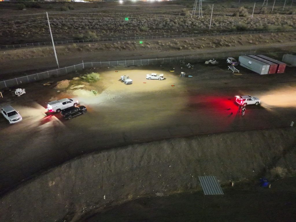
A specialized low-light aerial mapping training was recently conducted in the Phoenix, Arizona area with participation from 10 different law enforcement and fire agencies. The course combined classroom instruction with hands-on field exercises, emphasizing workflows, equipment, and software applications for aerial data collection in low-light and nighttime environments.
Classroom Session
The classroom portion of the training centered on:
- Current workflows used by participating agencies.
- Equipment and software commonly utilized for rendering aerial mapping data.
- The primary topic of leveraging long exposure aerial platforms for mapping collision and crime scenes.
- Discussions on drone hardware, camera settings, images versus video and the benefits of optimizing data capture.
- The use of RTK technology to achieve centimeter-level accuracy in mapping.
Equipment Focus
Most participants operated DJI aerial platforms paired with the DJI Pilot 2 app. Special emphasis was placed on using the Smart Capture mode in Pilot 2 for ideal data collection during low-light or nighttime operations.
Ground Control
A DJI RTK-3 multi-functional station was employed to collect ground control point data during each scenario, ensuring precision in subsequent photogrammetric processing.
Practical Exercises
Students participated in three distinct field scenarios designed to replicate real-world operating conditions:
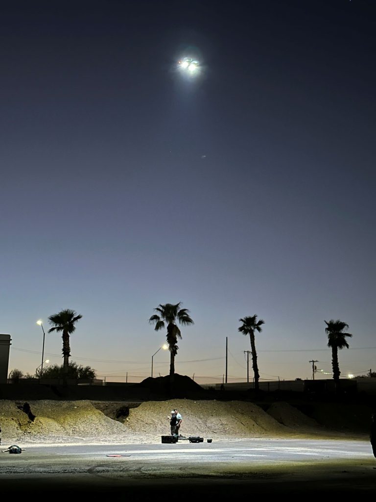
- Ground Scene Lighting – Mapping conducted with supplemental ground lighting.
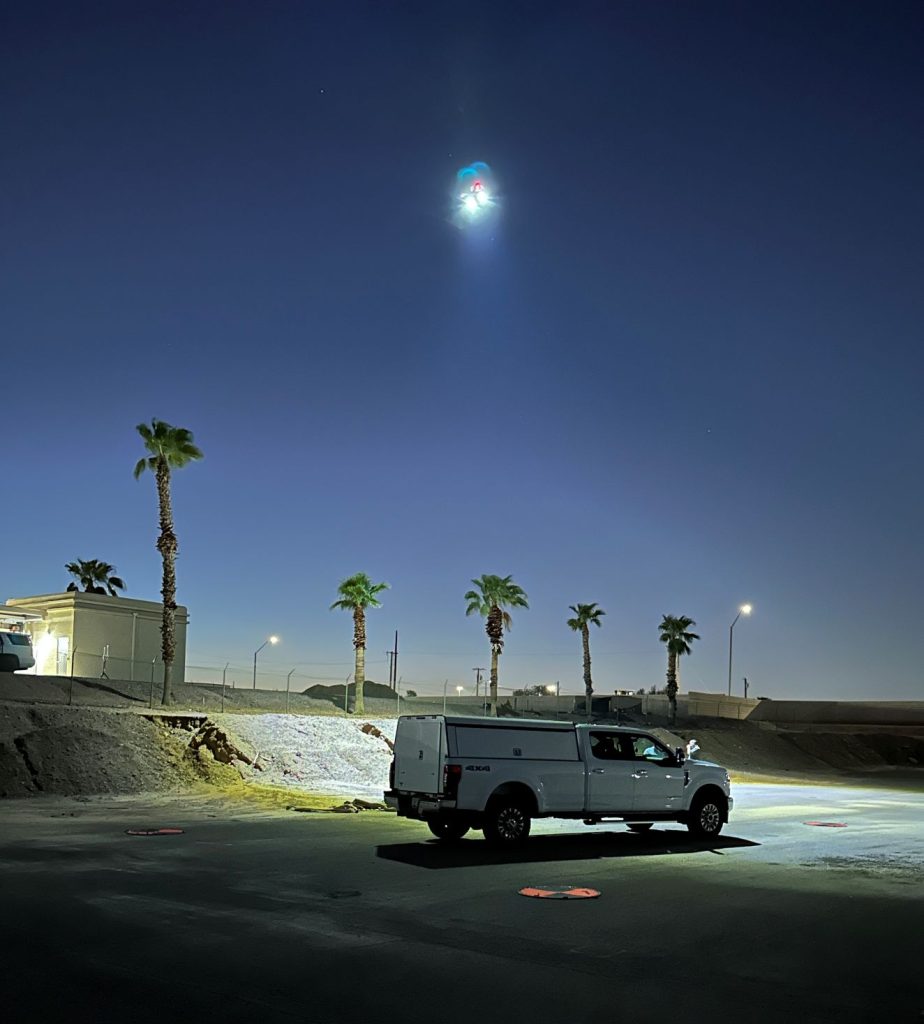
- Aerial Lighting – Utilization of a secondary aerial platform equipped with a light source.
- Complete Darkness – Students relied solely on the drone’s auxiliary bottom light for illumination.
Software Processing
Some of the data will be processed and compared using DJI Terra and Pix4Dmatic photogrammetry software. This side-by-side evaluation will allow students to identify key differences in processing workflows and final outputs between the two platforms.
The training provided participants with both theoretical knowledge and practical skills in low-light aerial mapping. By combining classroom discussions, varied field scenarios, and post-processing comparisons, attendees gained valuable insights to enhance their operational capabilities for collision and crime scene mapping under challenging lighting conditions.
